The maps below show a science park in 2008 and the same park today. Summarise the information by selecting and reporting the main features, and make comparisons where relevant.
Sample Answer The Maps Below Show a Science Park in 2008 and The Same Park Today
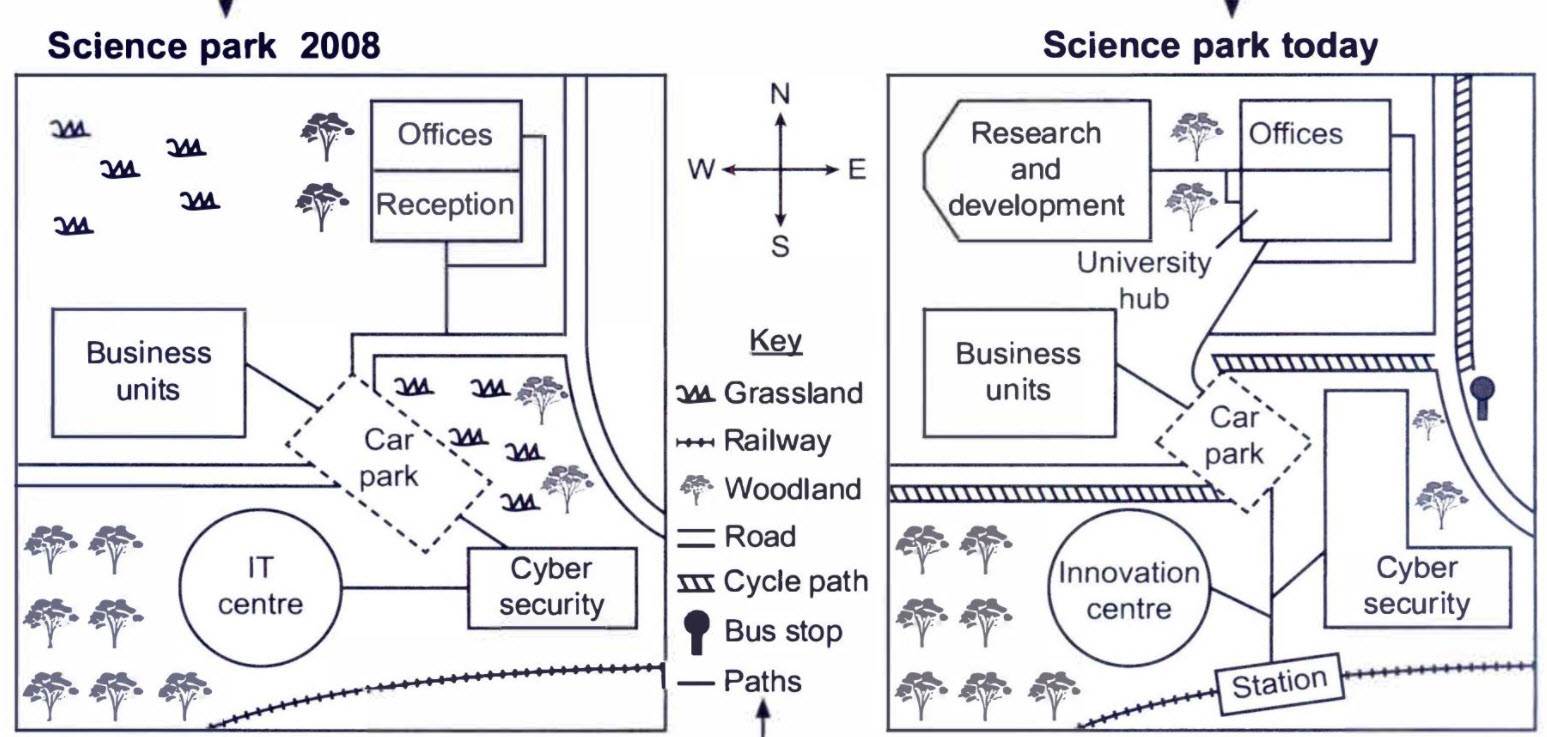
The maps give information about the changes made in a science park from 2008 to now.
Overall, in the beginning, the park had very few buildings built, and the rest was reminding as grassland, but by today these grasslands are converted as the hub for different purposes.
In 2008 the science park started with few units which have offices and reception on the north of the map and the cars was allowed to park in the Center of the map. From here, it gives way to business units and cyber security. The IT centre is on the west side of cyber security, and the rest are covered by the grassland, woodland. A railway line pass to the south.
By today, The reception has changed to a university hub, and the grasslands on the Northwest are converted to research and development. IT Center is made as Innovation Center, and a station has been built on the railway line. The path joins the station and connects to Innovation Centre and cyber security, and joins to the car park. The cycle path lay beside the road—the grasslands on the southeast help to enlarge the building size of cyber security.
Follow Us on Facebook
Also, Read The Chart Below Shows the Places Visited by Different People Living in Canada.